

The Case of Lima
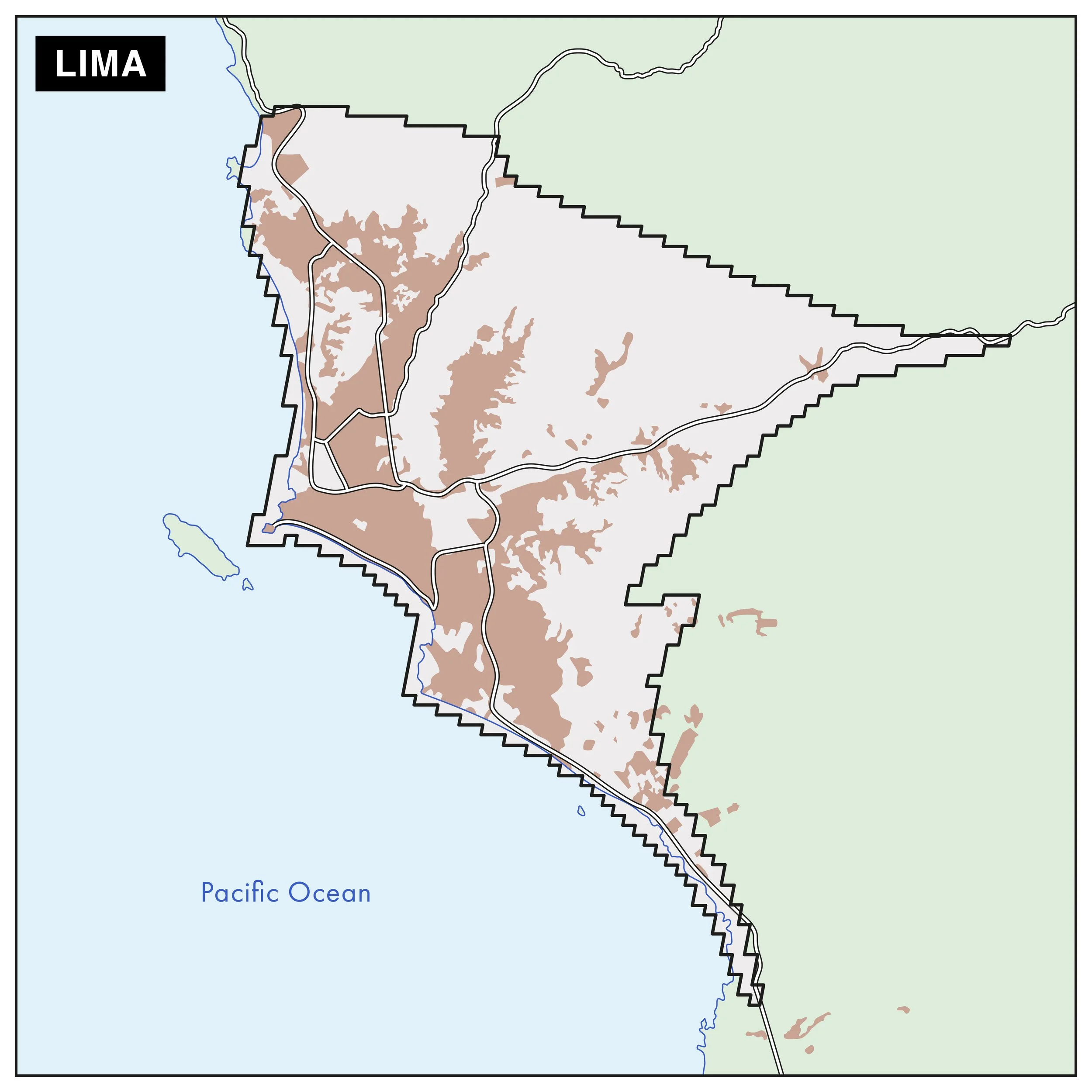
The functional urban area (FUA) of the Case Study in Lima
Lima, the capital of Peru, holds a prominent place in the country's history. Human presence in the region dates back centuries, indicating human activity during the late Ice Age. Founded in 1535 as the “Ciudad de los Reyes” (City of Kings), Lima has evolved into Peru’s largest city, home to over 11 million people, which is more than one-third of the national population and is the country’s primary economic hub. The city’s historical core retains colonial features such as the Plaza de Armas, Torre Tagle Palace, and the Presidential Palace, built on the site of Francisco Pizarro’s residence. Lima has experienced rural to urban area migration during the second half of the 20th century. Due to the large demand and shortage of housing, informal settlements have become the main mode of urban growth, often located in environmentally unsafe areas (e.g., due to landslides).
In terms of its environment, Peru is considered a “mega biodiverse” country and is home to over 500 mammal species, 70 of which are endemic; over 1,800 bird species; over 300 reptile species; over 380 amphibian species; and ca. 13,000 plant species. The rich biodiversity is mostly present in Peru’s tropical Amazon forests, the Andean mountains and along the extensive coastline, while cities remain largely disconnected from nature. Today, water scarcity is one of Lima’s most pressing challenges. The city receives only ca. 16 mm of rainfall per year, and its wate supply is dependent on three seasonal rivers and Andean glaciers, which are shrinking due to climate change.
I think we have to start from understanding, that creating green spaces are very important to change and to plant that seed of hope that we can have a better life, we can survive here, and it will change after that first seed. Because once you make the first effort, then the rest comes almost by itself.

Three examples of nature-based solutions in Lima
The “Humedal de Poza de la Arenilla” is an artificial coastal wetland located in the southern part of the district of La Punta, covering approximately 18.2 hectares (44 acres). It was created in 1967 following the construction of two rock breakwaters designed to protect the district’s southern coastline from marine erosion.
Bicentennial Park was part of Peru’s 200-year independence celebrations and reflects a blend of historical references and modern urban resilience strategies spanning over 30.400 square meters. Built between 2020–2022, the park uses Inca-inspired terrace systems to stabilize cliffs and prevent landslides, addressing long-standing coastal erosion risks.
Lomas El Mirador extends across the Lima city districts of Rímac (south), Independencia (west) and San Juan de Lurigancho (east), covering an area of more than 237 hectares. These hills are part of the fragile and seasonal lomas ecosystem, a unique coastal habitat that flourishes during the winter months due to fog moisture.
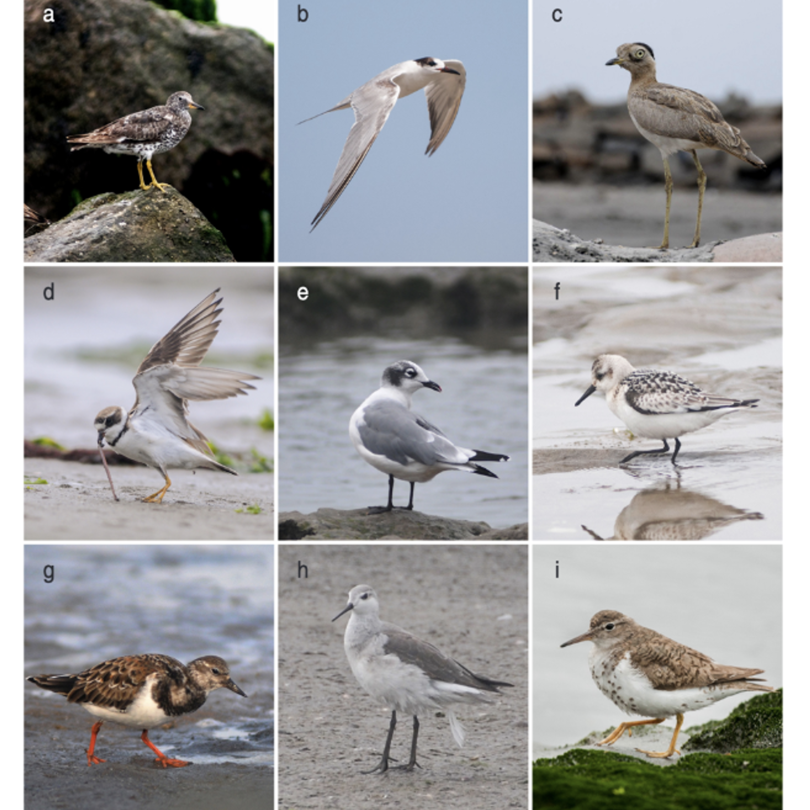
Figure 1: Shorebirds from Bird guide for this wetland. Photo: Jorge Podesta
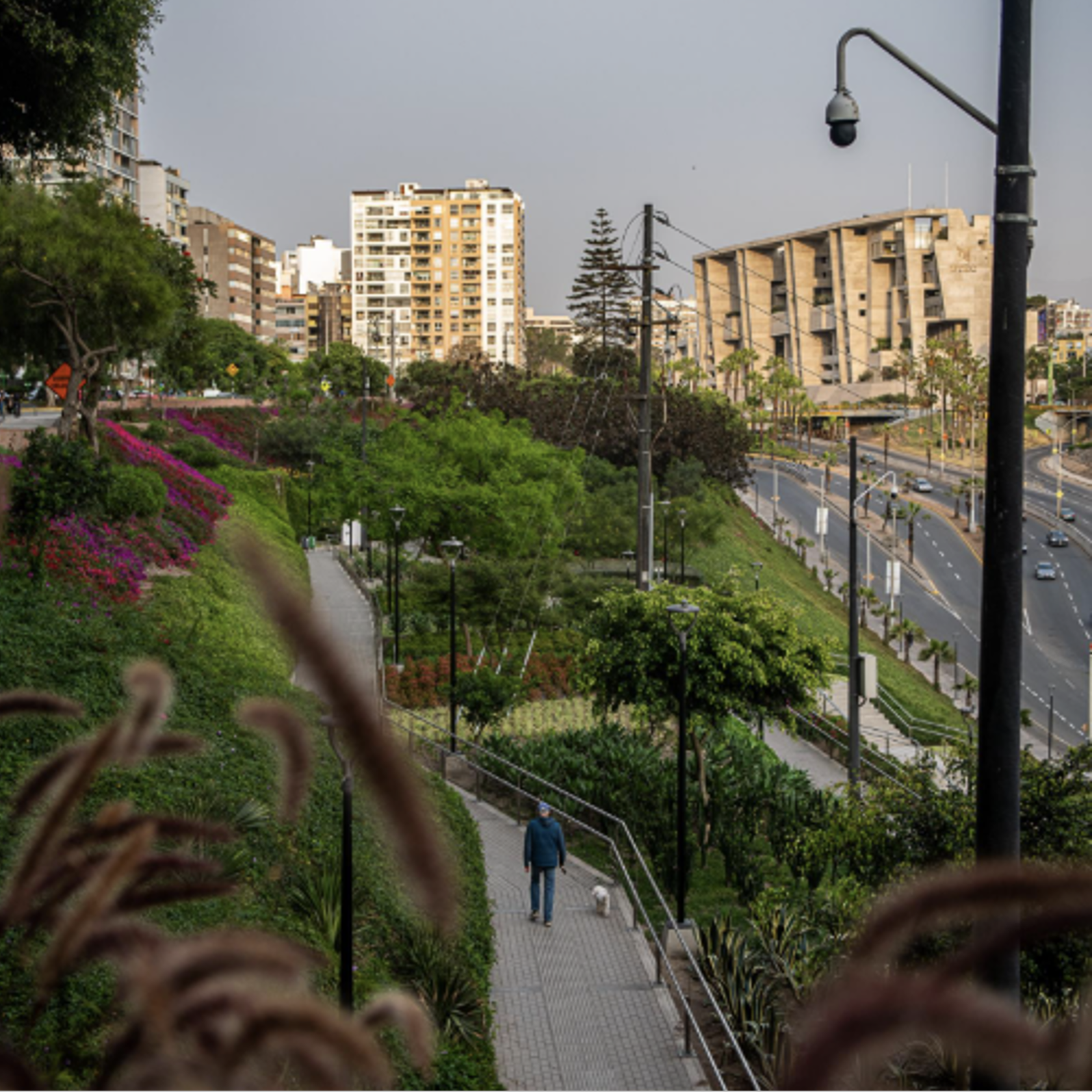
Figure 2: Photo of the Bicentennial Park in Miraflores. Photo: Philipp Montenegro
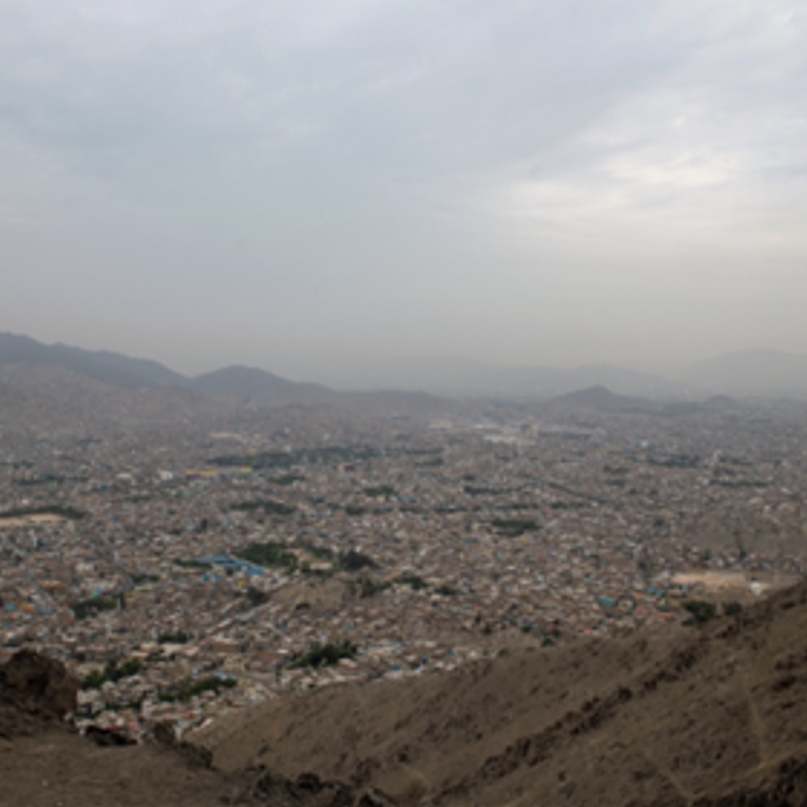
Figure 3: Photo of the hillside of “Lomas El Mirador” with the district of San Jaun de Lurigancho and Lima in the background. Photo: Philipp Montenegro